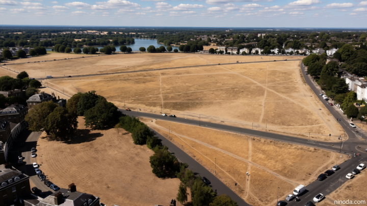

Summer warmth to return this week but rain will linger for some
Ninoda.com – Summer warmth to return this week as the UK experiences a gradual shift in weather patterns, with warmer temperatures expected to emerge following a relatively cooler stretch. The return of sunny days and milder conditions is anticipated to bring relief to many, though the presence of rain in certain regions may temper the overall experience. This transition highlights the dynamic nature of the British climate, where periods of dry heat are often interspersed with variable precipitation. While the UK as a whole may see a noticeable rise in temperatures, the forecast suggests that not all areas will be equally affected, with some regions continuing to feel the impact of lingering wet weather.
Heatwave Potential and Regional Variations
The anticipated return of summer warmth is set to peak midweek, particularly in central and eastern England, where high-pressure systems are expected to intensify. These systems, originating from mainland Europe, will create a more stable and sun-drenched environment, with temperatures climbing to 28°C (82°F) in areas like London, the Midlands, and the southeast. However, the weather’s unpredictability means that western Scotland and Northern Ireland may remain under a cloudier spell, with occasional showers persisting through the week. This regional divide underscores the importance of monitoring local forecasts, as the intensity of the heatwave will vary significantly depending on proximity to the UK’s western coast.
Despite the overall trend of warming, the British Isles are still likely to see a mix of dry and wet conditions. Meteorologists warn that the current weather patterns are influenced by the interplay of Atlantic winds and the North Sea, which can lead to sudden changes in temperature and precipitation. For example, while the southern regions of England may enjoy prolonged periods of sunshine, the north and west could face more frequent rain showers. This variability is a hallmark of the UK’s climate, and it means that the experience of summer warmth will depend on where one is located and the time of day.
Rainfall Patterns and Their Impact
Rainfall amounts this week will remain uneven, with the north and west of the UK expected to see more consistent precipitation. The 80 per cent chance of rain in these areas indicates that while sunny spells will occur, they may be short-lived, interrupted by brief downpours. In contrast, southern and eastern regions, including parts of the southeast and the south coast, will likely remain drier, with rainfall totals projected to be below average. This pattern is expected to ease as the week progresses, allowing the heat to settle more firmly in central and eastern areas.
The persistence of rain in some regions may have a noticeable impact on daily life. For instance, the combination of showers and cooler temperatures could delay the full onset of summer conditions in the north, affecting outdoor activities and travel plans. Additionally, the rain may help to replenish water reserves in areas that have experienced drought, while southern regions may see increased evaporation rates due to higher temperatures. This delicate balance between warmth and precipitation will require residents to adapt their routines and remain prepared for changing conditions.
As the UK transitions from cooler to warmer weather, the interplay between these factors will shape the overall climate experience. The first few days of the week may see a mix of light rain and intermittent sun, but by Thursday and Friday, the high-pressure systems are expected to dominate, leading to clearer skies and more consistent temperatures. This shift will create a stark contrast between regions, with some areas enjoying a true summer feel while others remain in a transitional phase. The meteorological data supporting this forecast includes a gradual weakening of Atlantic low-pressure systems and a strengthening of continental influences, which will dictate the weather’s trajectory for the coming days.
With summer warmth to return this week, the increased temperatures will have a ripple effect across various aspects of life. For example, the warmer conditions are likely to extend the grass pollen season, potentially leading to higher levels of allergens in the air. This could mean that individuals with hay fever may need to take extra precautions, such as using antihistamines or limiting outdoor exposure during peak pollen hours. At the same time, the sunnier days will increase UV levels, requiring greater attention to sun protection, particularly for those spending time outdoors.
Weather patterns will also influence agricultural activities, as the return of warmth is expected to benefit crops like wheat and barley in central England. However, the rain in the north and west may aid in the growth of grasses and other vegetation, creating a more diverse impact on the country’s farming sector. This duality in weather conditions serves as a reminder of the UK’s complex climate, where different regions can experience contrasting effects from the same broader trend. As the week unfolds, residents will need to stay informed about local forecasts to make the most of the summer conditions while being mindful of the lingering rain.